Tutte le segnalazioni del canale Telegram OsintOps News dal 2025 a oggi: strumenti, articoli e risorse OSINT scelti dalla redazione. Ogni notizia rimanda alla fonte originale.
82 notizie
- youtube.com
How I Geolocated Taliban Drills in the Afghan Desert: Let's Geolocate #8
This open source investigation tutorial demonstrates how to geolocate content in complex circumstances, such as geolocating a sand dune in a…
Leggi tutto
This open source investigation tutorial demonstrates how to geolocate content in complex circumstances, such as geolocating a sand dune in a desert. Using other features seen in a video, I was able to construct a geolocation timeline that eventually lead me to finding the exact sand dune where a strike happened in a desert. Starting from a Taliban propaganda video, I walk through the complete geo-profiling process: from identifying Kandahar Airfield to tracking the flights into empty desert, then matching dune formations to pinpoint the exact location. Important context: The Taliban are committing serious human rights abuses. This analysis doesn't endorse their activities, but it demonstrates verification methodology that journalists and researchers use to document military capabilities in restricted-access areas. Timestamps: 01:22 1. Identifying the base 04:22 2. Tracking the flight 07:21 3. Locating the soldier drop-off point 09:05 4. Finding the dune strike location 13:15 5. Why this geoprofiling matters The geo-profiling technique: When you can't rely on buildings or infrastructure, but you have multiple sources, either in one video, or a number of images, then geolocating the easier ones and building a timeline out of them can help with the more complex geolocations. In this case: 1. Identify the airbase 2. Find rough location of flights over the desert 3. Geolocate the soldier drop-off point 4. Track where the bombing happened Tools used: Google Earth Pro https://www.google.com/earth/versions Source video • د ایمان لښکر (۲) This tutorial is useful for: OSINT practitioners and digital investigators Journalists covering conflict zones Geolocation and GEOINT analysts Anyone learning desert terrain analysis Researchers documenting military activities
- raebaker.net
Be Mine: Tracking the Vessels in Russia's Barentsburg Cover Operation
A Russian research vessel, two sanctioned weapons transport ships, and synchronized AIS manipulation near a nuclear submarine base walk into…
Leggi tutto
A Russian research vessel, two sanctioned weapons transport ships, and synchronized AIS manipulation near a nuclear submarine base walk into a bar… In June 2025, three vessels exhibited synchronized AIS manipulation at Severodvinsk, Russia's nuclear submarine construction hub. The Russian-flaggged Professor Molchanov (IMO: 8010348), a research and tourism vessel owned by Roshydromet (Russian government hydrometeorological service) returning from a trip to Barentsburg and Pyramiden, alongside the Taimyr (IMO: 8821797) and Kapitan Yakovlev (IMO: 9077575), both sanctioned by the US and Ukraine in May 2022 for transporting Russian weapons (and Yakovlev for grain). All three were seen broadcasting suspiciously manipulated AIS positions over the Northern Dvina River between Arkhangelsk's port and Severodvinsk's submarine base, potentially masking military logistics movements.
- simonwillison.net
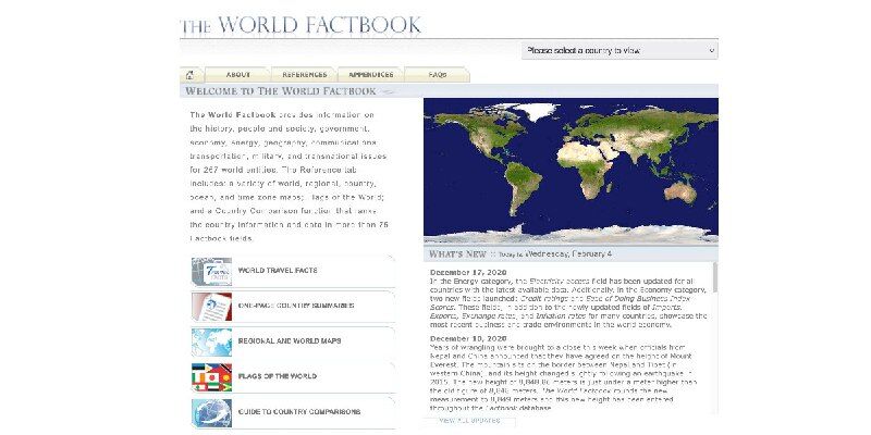
Spotlighting The World Factbook as We Bid a Fond Farewell
One of CIA’s oldest and most recognizable intelligence publications, The World Factbook, has sunset. There's not even a hint as to why they…
Leggi tutto
One of CIA’s oldest and most recognizable intelligence publications, The World Factbook, has sunset. There's not even a hint as to why they decided to stop maintaining this publication, which has been their most useful public-facing initiative since 1971 and a cornerstone of the public internet since 1997. In a bizarre act of cultural vandalism they've not just removed the entire site (including the archives of previous versions) but they've also set every single page to be a 302 redirect to their closure announcement.
- x.com
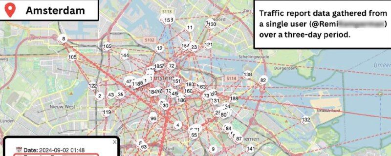
How Waze quietly built the world's largest crowdsourced surveillance systemLink
Waze is one of those apps that feels like magic. You're stuck in traffic, someone ahead reports a jam, and suddenly your route updates…
Leggi tutto
Waze is one of those apps that feels like magic. You're stuck in traffic, someone ahead reports a jam, and suddenly your route updates. Police speed trap ahead? A fellow driver already flagged it. It's crowdsourced navigation at its finest, millions of people helping millions of other people get where they're going faster. But here's something most people don't think about: every time you tap that little "report" button, you're broadcasting your exact location, the precise time, and your username to anyone who knows where to look. And I mean anyone. This isn't a vulnerability. It's not a bug. It's how the system was designed. Waze makes this data available through their public web map, and with a bit of patience and some basic scripting, you can turn that helpful traffic app into a global surveillance system capable of tracking individuals across 60 countries.
- github.com
The Art of Pivoting
This book explores how intelligence and cyber-security analysts can uncover hidden links between threat actor infrastructure and ongoing…
Leggi tutto
This book explores how intelligence and cyber-security analysts can uncover hidden links between threat actor infrastructure and ongoing investigations by pivoting on both classic and unconventional indicators — many of which are often overlooked. The material is grounded in empirical, field-tested strategies used in cyber-security, digital forensics, cyber threat intelligence, and intelligence analysis more broadly. Our goal is to provide analysts with a practical toolkit of analytical methods, supported by real-world examples, to enhance investigative workflows without locking them into a single mindset, strict model, or overly rigid technical strategy. Instead, the book encourages creative exploration, data-driven reasoning, and the use of diverse data points — from traditional IOCs to subtle metadata traces — as part of a flexible and repeatable analytical process. The approach presented throughout this book is intentionally built upon open-source tooling, most notably the MISP threat intelligence platform and the AIL Project. By relying on transparent and widely adopted tools, every technique described here can be reproduced, validated, and reused by analysts, researchers, educators, or incident response teams. This ensures that the methodology is not theoretical or proprietary, but openly verifiable, community-driven, and designed to evolve. The book itself follows the same philosophy: it is an open, living document, publicly versioned, and contributions are welcomed directly via Git. Readers are encouraged to experiment, improve, and extend the content, making the entire workflow repeatable, auditable, and collaborative within the wider defensive security community.
- github.com
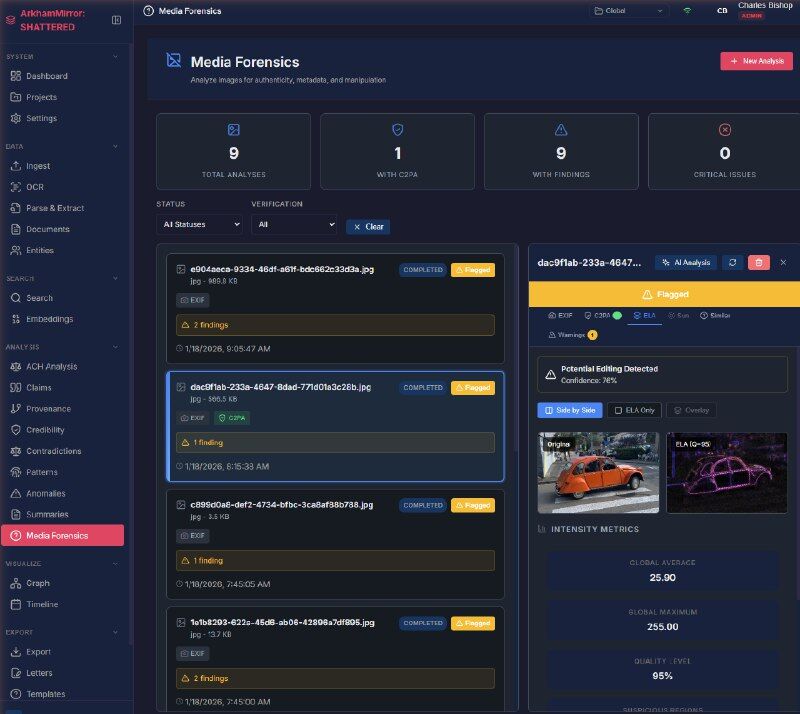
ArkhamMirror
ArkhamMirror is an air-gapped, AI-powered investigation platform for journalists and researchers. It runs 100% locally on your machine…
Leggi tutto
ArkhamMirror is an air-gapped, AI-powered investigation platform for journalists and researchers. It runs 100% locally on your machine, turning chaos into order using advanced NLP, Vision AI, and Knowledge Graphs. https://github.com/mantisfury/ArkhamMirror
- dutchosintguy.com
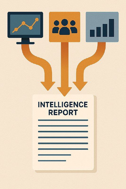
OSINT Analysis Intelligence Report Writing
Intelligence reports are the culmination of our OSINT efforts, transforming raw data into actionable insights that decision-makers can use…
Leggi tutto
Intelligence reports are the culmination of our OSINT efforts, transforming raw data into actionable insights that decision-makers can use. I've spent over two decades conducting OSINT investigations, and if there's one thing I've learned, it's that our work is only as valuable as our ability to communicate it effectively. The collection phase is usually what gets OSINT practitioners excited, the thrill of the hunt, finding that crucial piece of information that breaks open a case. But the analysis and reporting phase is where we truly add value, transforming disparate bits of information into a coherent narrative that drives action. This blog I will attempt to walk you through creating professional OSINT reports that effectively communicate your findings.
- github.com
Digital Image Forensics: A quantitative & qualitative comparison between State-of-the-art-AI and Traditional Techniques…
Thesis with practical examples and thoughtful analysis for using the "JPEG Ghosts", "Image Resampling" and "Noise Wavelet Blocking" tools…
Leggi tutto
Thesis with practical examples and thoughtful analysis for using the "JPEG Ghosts", "Image Resampling" and "Noise Wavelet Blocking" tools implemented in Sherloq. This work also offers insights towards the use and reliability of AI driven approaches in Digital Image Forensics.
- osintops.com
Emoji: i segnali nel rumore digitale
L'emoji può' diventare un dato di intelligence. Le comunità online le usano per segnalare l'identità di gruppo, comunicare in codice e…
Leggi tutto
L'emoji può' diventare un dato di intelligence. Le comunità online le usano per segnalare l'identità di gruppo, comunicare in codice e aggirare la moderazione dei sistemi di monitoraggio. Il loro significato non è universale, ma contestuale che individuato e capito.
- blackhat.com
A Picture's Worth: Digital Image Analysis and Forensics
LINK by Neal Krawetz Paper with practical examples and thoughtful analysis for techniques that have since been implemented in Sherloq
- androidauthority.com
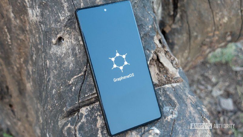
GrapheneOS is finally ready to break free from Pixels, and it may never look back
– The makers of GrapheneOS have confirmed they are partnering with a major Android OEM to bring the privacy-focused Android fork to…
Leggi tutto
– The makers of GrapheneOS have confirmed they are partnering with a major Android OEM to bring the privacy-focused Android fork to Snapdragon-powered smartphones. – The project has confirmed it’s bringing support for Pixel 10, but is unsure whether support will continue for Pixel 11. – GrapheneOS didn’t reveal the name of its new partner, but said that those devices will be priced in the same range as Pixels.
- shadowdragon.io
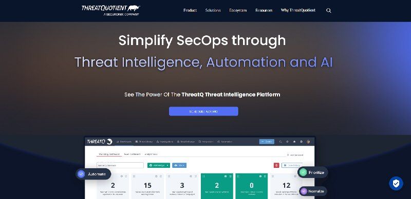
21 Best Threat Intelligence Platforms (2025 Guide)
Security teams today face overwhelming volumes of raw threat data across the surface, deep, and dark web, making it harder to identify real…
Leggi tutto
Security teams today face overwhelming volumes of raw threat data across the surface, deep, and dark web, making it harder to identify real risks. Threat Intelligence Platforms (TIPs) are essential because they aggregate, enrich, and prioritize this data into actionable intelligence, integrate with existing security systems (like SIEM, SOAR, and EDR), and help analysts cut through noise to respond faster and more effectively.
- osintops.com
Debriefing di un Cuore Spezzato: La Recensione di “Guerra Cognitiva Sentimentale”
La più comune deformazione professionale di un analista d’intelligence è il mettersi ad analizzare tutto, relazioni sentimentali comprese…
Leggi tutto
La più comune deformazione professionale di un analista d’intelligence è il mettersi ad analizzare tutto, relazioni sentimentali comprese. Guerra Cognitiva Sentimentale di Astore dei Boschi parte proprio da questo assunto, analizzando una “non relazione” come se fosse uno scenario di guerra L’autore applica i concetti di HUMINT, bias cognitivo e guerra cognitiva al campo degli affetti, scrivendo un saggio che è al tempo stesso un ritratto implacabile di se stesso e una denuncia della “società dei cazzari”.
- github.com
bitchat
– Decentralized Mesh Network: Automatic peer discovery and multi-hop message relay over Bluetooth LE – End-to-End Encryption: X25519 key…
Leggi tutto
– Decentralized Mesh Network: Automatic peer discovery and multi-hop message relay over Bluetooth LE – End-to-End Encryption: X25519 key exchange + AES-256-GCM for private messages – Room-Based Chats: Topic-based group messaging with optional password protection – Store & Forward: Messages cached for offline peers and delivered when they reconnect – Privacy First: No accounts, no phone numbers, no persistent identifiers – IRC-Style Commands: Familiar /join, /msg, /who style interface – Message Retention: Optional room-wide message saving controlled by room owners – Universal App: Native support for iOS and macOS – Cover Traffic: Timing obfuscation and dummy messages for enhanced privacy – Emergency Wipe: Triple-tap to instantly clear all data – Performance Optimizations: LZ4 message compression, adaptive battery modes, and optimized networking
- github.com
Blockchain OSINT resources
A collection of tools and resources useful for OSINT investigations in the cryptocurrency. This is a dynamic list. most resources here are…
Leggi tutto
A collection of tools and resources useful for OSINT investigations in the cryptocurrency. This is a dynamic list. most resources here are from investigations I've done. – Blockchain Explorers – Crypto OSINT Analysis & Learning – APIs & Data Sources – Compliance, Risk, & AML Resources – Learning Resources – Investigation Workflows from cybdetective
- github.com
Docling
Docling simplifies document processing, parsing diverse formats — including advanced PDF understanding — and providing seamless integrations…
Leggi tutto
Docling simplifies document processing, parsing diverse formats — including advanced PDF understanding — and providing seamless integrations with the gen AI ecosystem.
- e-education.psu.edu
Welcome to GEOG 571 – Intelligence Analysis, Cultural Geography, and Homeland Security
This course examines and illuminates the relationships between cultural geography, civil security, and the stability of the existing world…
Leggi tutto
This course examines and illuminates the relationships between cultural geography, civil security, and the stability of the existing world order. It rests firmly upon the application of the tools of spatial analysis that are at the heart of the discipline of geography, and is designed to help students develop the analytical processes that will lead to enlightened syntheses (intelligence products) about the connections associated with cultural differences and current internal and external threats to the security of the American homeland. It also is designed to encourage students to examine the impacts of cultural differences on the stability of the existing world order. The overarching objective of this course is to help successful students develop the knowledge, comprehension, and skills needed to effectively analyze current geospatial realities and, through the prism of cultural geography, create a rational predictive synthesis (intelligence summary) about potential human threats to the security of the nation. The course consists of projects, associated readings, written assignments, and discussions.
- jalblas.com
TryHackMe: Searchlight – IMINT Walkthrough – Jasper Alblas
A walkthrough for a TryHackMe room focused on Image Intelligence (IMINT) and Geospatial Intelligence (GEOINT), suitable for beginners in…
Leggi tutto
A walkthrough for a TryHackMe room focused on Image Intelligence (IMINT) and Geospatial Intelligence (GEOINT), suitable for beginners in OSINT.